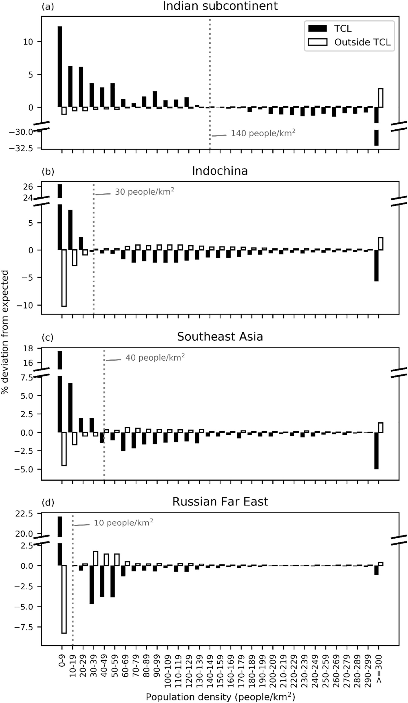
Refactored and automated analysis, graphing, and mapping code to estimate effects within areas important to tigers of human population increase under each of the five Shared Socioeconomic Pathways (SSPs) in support of a paper with Eric Sanderson and Jesse Moy.
Things I do/did: Spatial analysis, arcpy-based model and mapmaking scripting, graph production
Tools/tech involved: ArcGIS and arcpy, python, numpy, pandas, matplotlib

