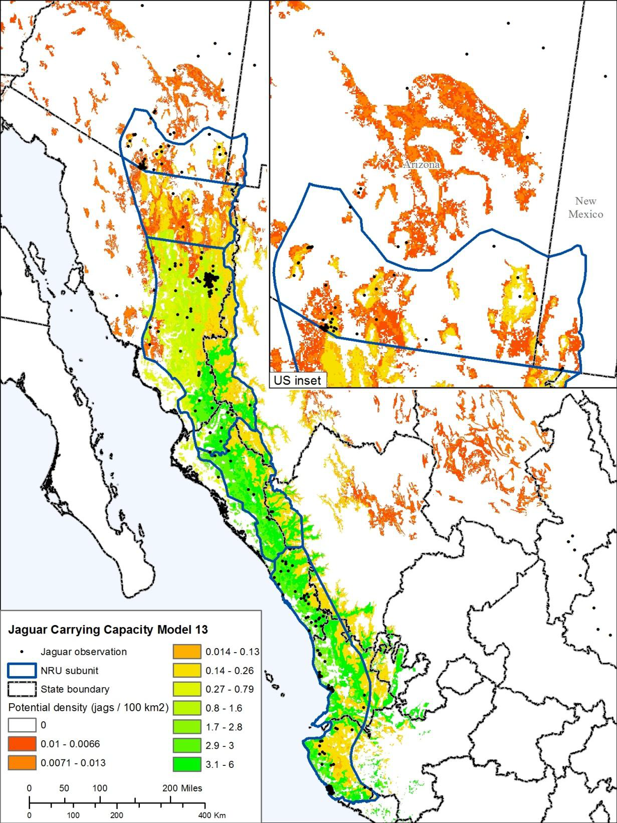
Comprehensive habitat modeling, conducted for the US Fish and Wildlife Service, for jaguars in the extreme northern edge of their range, including the collation of all known jaguar observations in the area, historical and modern, as well as structured scientific surveys, allowing for potential population estimates. The work spanned three years and included several updates to data and calculations via workshops and meetings with the FWS-convened Jaguar Recovery Team, as well as ongoing consultation in the process of creating a Recovery Plan and other documents. The observation and habitat modeling work led to the creation of jaguardata.info as well as two forthcoming papers in collaboration with the Defenders of Wildlife supporting a northern extension of land designated for jaguar protection.
Things I do/did: Spatial analysis, map production
Tools/tech involved: ArcGIS, arcpy
