KIM FISHER

  • Development
  • Spatial
  • Tools
  • Creative
  • About
    • Contact
  • GitHub
  • LinkedIn
  • Twitter

TAG: arcgis

Asian elephant RWPS

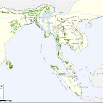
Range-wide priority setting (RWPS) exercise for Asian elephants

Tagged With: arcgis, arcpy, species / habitat modeling

Northern jaguar habitat

Comprehensive habitat modeling and observation database creation conducted for the USFWS for northern jaguars

Tagged With: arcgis, arcpy, python

Snow leopard RWPS

Range-wide priority setting (RWPS) exercise for snow leopards

Tagged With: arcgis, species / habitat modeling

Chang Tang LSA

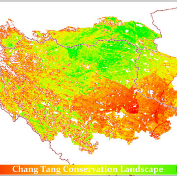
Landscape Species Approach analysis of Chang Tang area of Tibet

Tagged With: arcgis, species / habitat modeling

Human Footprint 2 website and atlas

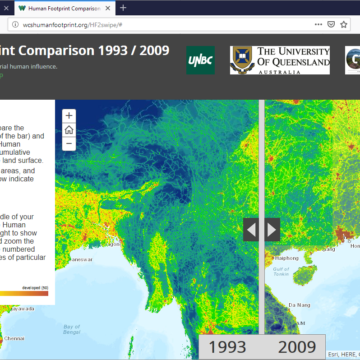
Website produced very rapidly showcasing WCS/UQ reanalysis of global human footprint

Tagged With: arcgis, arcpy, esri js API, numpy, python

Jamaica Bay NYCJamaica Bay resilience modeling

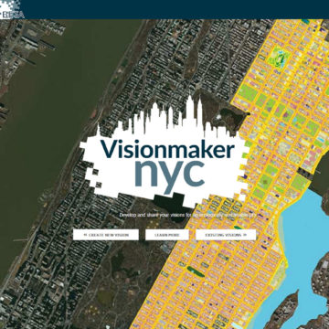
Visionmaker-based ecological modeling piece of integrated flood/ecology/pollution coastal resilience modeling

Tagged With: arcgis, arcpy, python, species / habitat modeling, Visionmaker

Welikia splitscreenMannahatta / Welikia

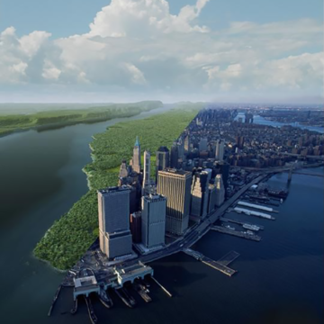
Welikia is the extension of Mannahatta to all of New York City, where the the urban landscape is envisioned as it was 400 years ago

Tagged With: arcgis, arcpy, django, Mannahatta/Welikia, mysql, php, postgresql/postgis, python, wordpress

Visionmaker splash pageVisionmaker NYC

Web application for developing ecologically sustainable visions of New York City via “ecosystem painting” tools

Tagged With: arcgis, arcpy, django, esri js API, gdal/ogr, jquery, numpy, pandas/matplotlib, postgresql/postgis, python, redis, species / habitat modeling, Visionmaker

  • Email
  • GitHub
  • LinkedIn
  • Twitter

Copyright © 2023 · Kim Fisher