KIM FISHER

  • Development
  • Spatial
  • Tools
  • Creative
  • About
    • Contact
  • GitHub
  • LinkedIn
  • Twitter

TAG: Mannahatta/Welikia

Disturbance modeling

Scripts for modeling the effects of fire, horticulture, and beaver ponds on 1609 NYC landscape over prior 200 years

Tagged With: arcpy, gdal/ogr, Mannahatta/Welikia, numpy, pandas/matplotlib, python, species / habitat modeling

Shanghai SDR databaseSDR / placename databases

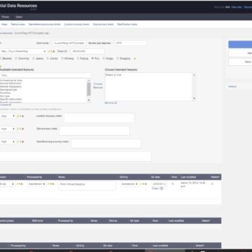
Database interface application for administering Spatial Database Resources (SDRs) and placenames

Tagged With: django, Mannahatta/Welikia, mysql, php, postgresql/postgis, python

Welikia species observations databaseNYC species observations database

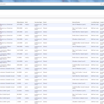
Customized Django admin application for updating comprehensive database of all NYC species observations

Tagged With: django, Mannahatta/Welikia, postgresql/postgis, python, species / habitat modeling

Muir Web interactive visualizationMuir Web

Database graph-based network analysis that predicts species and atrophic element distributions

Tagged With: django, gdal/ogr, java, Mannahatta/Welikia, mysql, numpy, postgresql/postgis, python

Welikia web mapWelikia web map

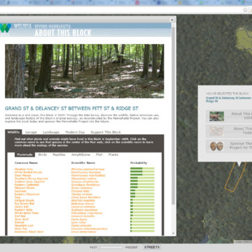
Web map for showing probable 1609 species and landscape features for any block

Tagged With: google maps API, jquery, Mannahatta/Welikia, mysql, php, postgresql/postgis

Welikia splitscreenMannahatta / Welikia

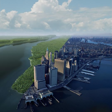
Welikia is the extension of Mannahatta to all of New York City, where the the urban landscape is envisioned as it was 400 years ago

Tagged With: arcgis, arcpy, django, Mannahatta/Welikia, mysql, php, postgresql/postgis, python, wordpress

  • Email
  • GitHub
  • LinkedIn
  • Twitter

Copyright © 2025 · Kim Fisher