Geospatial analysis pipeline for producing new version of global Human Footprint and species habitat
Human Footprint / SCL analysis pipeline
Geospatial analysis pipeline for producing new version of global Human Footprint and species habitat
Jupyter/ipywidget/plotly code to automate the production and exploration of GHG emissions and GDP data by country
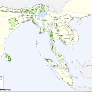
Range-wide priority setting (RWPS) exercise for Asian elephants
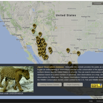
Comprehensive habitat modeling and observation database creation conducted for the USFWS for northern jaguars
Range-wide priority setting (RWPS) exercise for snow leopards
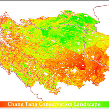
Landscape Species Approach analysis of Chang Tang area of Tibet
Script for splitting recce lines to represent consistent sampling
Saves out individual rasters from a source base raster, masked by a feature class of polygonal features
Script for creating recce lines from excel files
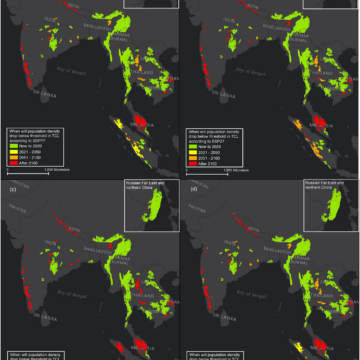
Analysis of effects of SSP-modeled population changes on tiger habitat
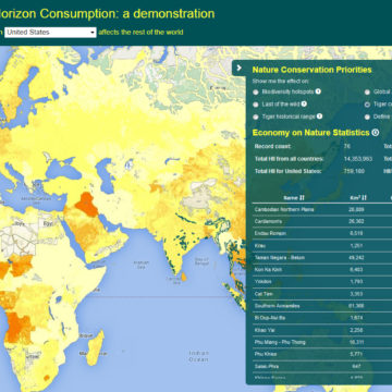
Web application allowing user to see a map of the impact of the consumption in one country on the rest of the world
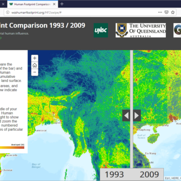
Website produced very rapidly showcasing WCS/UQ reanalysis of global human footprint
Shell scripts and configuration files to turn incoming GOES-16 signal via SDR into png files
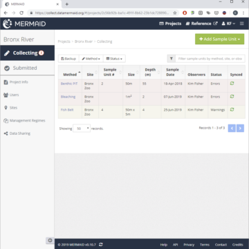
Simple public-facing map-based dashboard providing high-level summary view of coral reef data collected using MERMAID
Angular web app that uses a Service Worker to provide offline coral reef data entry via a web app in the field
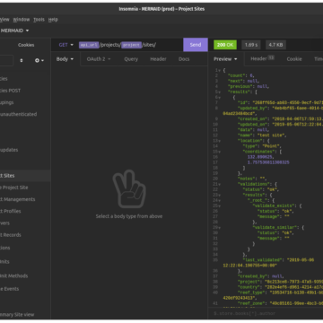
MERMAID APIs using Django REST Framework, Lambda and Zappa
A website accompanying the exhibition ‘From Farm to City: Staten Island, 1661-2012’ at the Museum of the City of New York
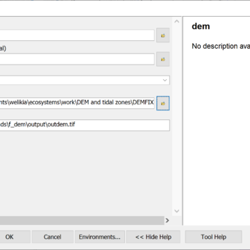
Script for making small manual adjustments to a DEM
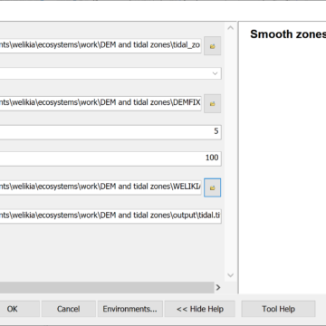
ArcGIS python tool created for Welikia that creates a continuous raster surface gradually interpolating between contiguous polygons
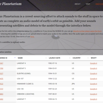
Realtime spatial audio model of the objects orbiting Earth
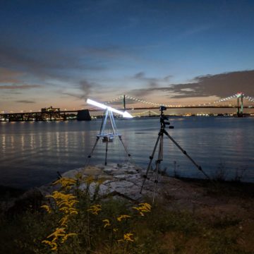
Node-based software for keeping a glowing arrow continually pointing at the moon
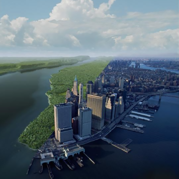
Visionmaker-based ecological modeling piece of integrated flood/ecology/pollution coastal resilience modeling
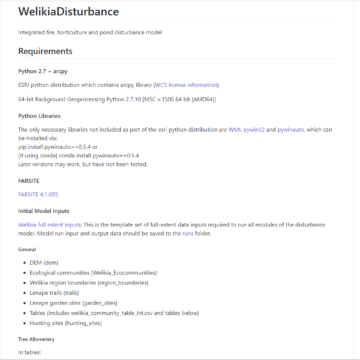
Scripts for modeling the effects of fire, horticulture, and beaver ponds on 1609 NYC landscape over prior 200 years
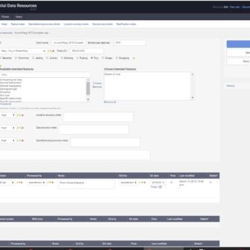
Database interface application for administering Spatial Database Resources (SDRs) and placenames
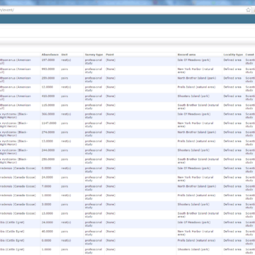
Customized Django admin application for updating comprehensive database of all NYC species observations
Database graph-based network analysis that predicts species and atrophic element distributions
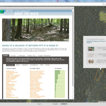
Web map for showing probable 1609 species and landscape features for any block
Map-based application for viewing observations of jaguars across the northern part of their range according to user-defined criteria for observation validity
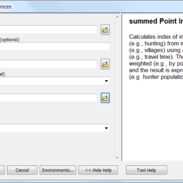
The summed Point Influence (SPI) tool estimates cumulative influence on an area from a set of geographic features
Welikia is the extension of Mannahatta to all of New York City, where the the urban landscape is envisioned as it was 400 years ago
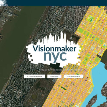
Web application for developing ecologically sustainable visions of New York City via “ecosystem painting” tools